The Enigmatic Island: 15 Fascinating Facts About Madagascar
Separated from the supercontinent Gondwana tens of millions of years ago, Madagascar evolved in near-total ecological isolation off the eastern coast of Africa. Today, it stands as the world's fourth-largest island, home to landscapes that range from razor-sharp limestone forests to arid desert biomes. Its extraordinary red soils and incredible levels of plant and animal endemism have earned it a reputation as a living laboratory of evolution. From hidden pirate coves along the indented west coast to sacred giant baobab trees, Madagascar offers a realm of wonder unlike anywhere else on Earth.
1. It Is the World's Fourth-Largest Island
Covering over 587,000 square kilometers in the western Indian Ocean, Madagascar is the fourth-largest island on Earth after Greenland, New Guinea, and Borneo. Because it split from the Indian subcontinent around 88 million years ago, its flora and fauna evolved in almost complete isolation. This long period of geographic separation allowed species to diversify into forms seen nowhere else on the planet. Many geologists and biologists refer to Madagascar as an "eighth continent" due to its distinct evolutionary history and sheer ecological variety. Walking across its landscape reveals ecosystems that feel completely detached from neighboring mainland Africa.
2. The Soil Gave It the Nickname "The Great Red Island"
Madagascar is famously referred to as the "Great Red Island" because of its distinctive red laterite soil. Rich in iron oxide and aluminum, this intensely colored earth covers much of the central highlands and rolling hills. From high altitude or satellite orbit, the rivers flowing off the island look as though they are bleeding bright crimson into the ocean. While striking to look at, laterite soil is often nutrient-poor and prone to heavy erosion when natural vegetation is cleared. Despite its agricultural challenges, this vivid red earth remains an iconic symbol of the Malagasy landscape.
3. Tsingy de Bemaraha Features a Forest of Stone Needles
Located on the western coast, the Tsingy de Bemaraha National Park contains one of the most surreal geological formations in the world. The word "tsingy" translates locally to "where one cannot walk barefoot," describing the razor-sharp limestone karsts that dominate the reserve. Over millions of years, groundwater eroded massive limestone deposits, carving deep gorges and towering vertical stone shafts. Remarkably, despite the treacherous terrain, unique species of lemurs and plants thrive in the high canopy and deep canyons of this stone fortress. It is recognized as a UNESCO World Heritage site and attracts adventurous travelers from around the globe.
4. Its Spiny Forests Host 95% Endemic Plant Species
In the arid southwestern region of Madagascar lies the spiny forest, an ecoregion found nowhere else on Earth. Plants here have evolved extraordinary adaptations to endure long droughts, resulting in bloated trunks, thick waxy leaves, and dense thorn networks. An incredible 95% of the plant species in these dry thickets are entirely endemic to Madagascar, including many species of the octopus tree family. These spiny woodlands also provide critical habitat for rare reptiles and the iconic ring-tailed lemur. Sadly, this delicate ecosystem faces increasing threats from charcoal production and agricultural expansion.
5. The Highest Peak Rises Nearly 2,880 Meters Above Sea Level
Madagascar is far from flat, featuring a dramatic central mountainous spine running down its length. The highest point on the island is Mount Maromokotro, reaching an elevation of 2,876 meters in the Tsaratanana Massif. Located in the remote northern region, this granitic mountain complex is notoriously difficult to trek and remains largely untouched. The high-altitude environment surrounding the peak shelters unique montane ecosystems that differ vastly from the coastal rainforests. Cold temperatures and frequent cloud cover characterize these summits, creating isolated havens for specialized high-altitude species.
6. Ancient Rift Valleys Form Large Inland Lakes
Madagascar's geological history is tied to the same tectonic forces that created the East African Rift system. This tectonic activity formed deep inland basins that now host large freshwater bodies, most notably Lake Alaotra. Situated in the central north, Lake Alaotra is Madagascar's largest lake and serves as a crucial agricultural and ecological center. The wetlands surrounding the lake are the sole habitat for the critically endangered Gentle Lemur, locally known as the bandro. However, siltation caused by deforestation in surrounding hills poses a continuous threat to these ancient aquatic environments.
7. Antsiranana Harbor Is One of the World's Deepest Natural Ports
At the northern tip of Madagascar lies Antsiranana Bay, formerly known as Diego Suarez. This natural harbor is widely considered one of the largest and deepest natural ports in the world, second only to Sydney Harbor in Australia. Surrounded by dramatic volcanic peaks and rugged terrain, the bay features a central conical islet named Pain de Sucre, or Sugar Loaf. Historically, its strategic deep-water access made it a coveted military base for French forces during the colonial era. Today, it remains an essential maritime gateway and a picturesque marvel of northern Madagascar.
8. The Treacherous East Coast Is Known for Sharks and Rough Seas
Madagascar's eastern shoreline faces the open expanse of the Indian Ocean, creating dramatic contrasts with the calm west coast. The waters along this coast feature steep underwater beach drops, powerful ocean currents, and heavy surf conditions. Furthermore, these warm eastern waters are frequented by several species of sharks, making swimming exceptionally hazardous in many areas. Trade winds blow moisture directly against eastern mountain slopes, driving relentless rainfall that feeds lush rainforests along the coast. Travelers visiting the east coast often marvel at the crashing ocean waves while keeping a safe distance from the shore.
9. The Indented West Coast Was Once a Haven for Pirates
In stark contrast to the east, Madagascar's western coastline is deeply indented with hundreds of protected bays, estuaries, and river mouths. During the late 17th and early 18th centuries, these hidden coves provided ideal hideouts for infamous ocean pirates preying on trade routes in the Indian Ocean. Legendary figures like Captain William Kidd and Henry Every used the secluded anchorages to repair ships, restock supplies, and store stolen treasure. The island of Île Sainte-Marie off the northeast coast even contains a historic pirate cemetery that remains popular with tourists today. The complex topography of the west coast continues to host quiet fishing villages and sheltered anchorages.
10. Central Highlands Display Volcanic Landscapes and Rice Terraces
The interior of Madagascar is dominated by high-altitude plateaus known as the Central Highlands. This region features a mosaic of extinct volcanic craters, massive granite inselbergs, and fertile valleys. Over centuries, local communities transformed the landscape by constructing intricate irrigated rice terraces that cover hill slopes. Rice is the dietary staple of Madagascar, and the emerald-green terraced fields remain a defining feature of the highland rural landscape. Cold morning mists and traditional red-brick houses give this central region a distinctly unique atmosphere.
11. Six Microclimates Range from Rainforests to Deserts
Despite being a single island, Madagascar exhibits remarkable climatic diversity across its regions. The easterly trade winds bring heavy rainfall to the eastern slopes, creating warm, dense tropical rainforests. In contrast, the central highlands experience temperate, cooler conditions with distinct wet and dry seasons. Meanwhile, the southwest lies in a rain shadow, receiving very little annual precipitation and giving rise to semi-arid desert biomes. This extreme climate variation within relatively short distances has driven the evolution of highly specialized local flora and fauna.
12. Over 90% of Its Wildlife Is Found Nowhere Else
Madagascar is widely regarded by biologists as one of the most biodiversity-rich places on Earth. Approximately 90% of all plant and animal species found on the island are endemic, meaning they do not exist naturally anywhere else. Famous endemics include over 100 species of lemurs, half of the world's chameleon species, and bizarre predators like the fossa. This incredible density of unique life makes the island an irreplaceable priority for global conservation efforts. Preserving these habitats is critical, as losing a species in Madagascar means losing it from the planet forever.
13. It Is Home to Six Endemic Baobab Species
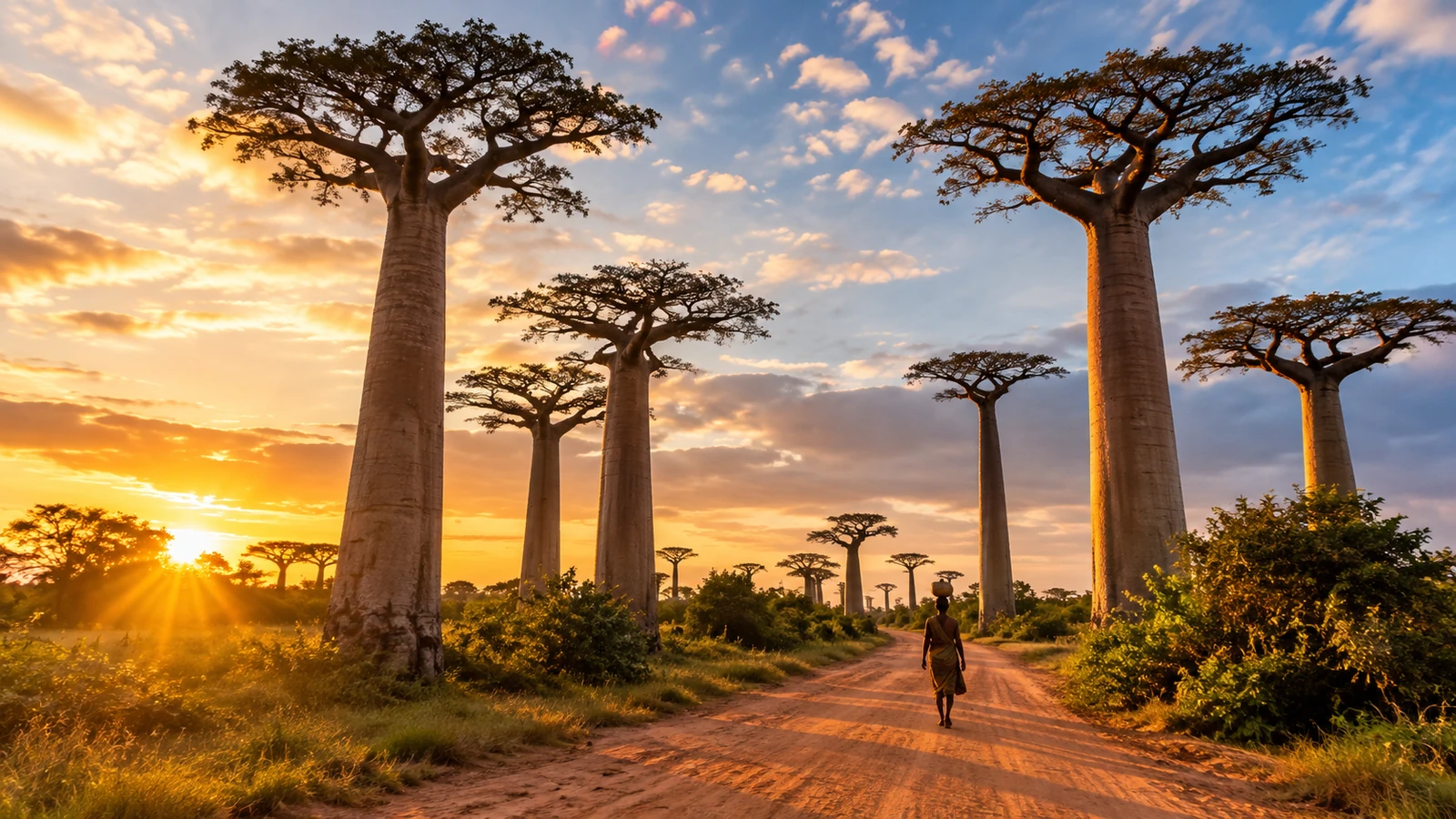
While all of mainland Africa shares just one species of baobab tree, Madagascar boasts six distinct endemic species. These magnificent trees, often called "upside-down trees" due to their root-like branch networks, can live for over a thousand years. The famous Avenue of the Baobabs near Morondava features a striking cluster of Grandidier's baobabs lining a dirt road, drawing visitors from across the globe. Baobabs store massive amounts of water in their swollen trunks to survive prolonged dry seasons. Local cultures hold these ancient giants in deep reverence, often considering them sacred symbols of the landscape.
14. Deforestation Threatens the Eastern Rainforests
Despite its ecological riches, Madagascar faces severe environmental challenges primarily driven by habitat destruction. Traditional slash-and-burn agriculture, known locally as tavy, cleared large swathes of forest for cattle grazing and rice farming. Logging for valuable hardwoods like rosewood has further depleted primary rainforests across the eastern region. Today, much of the remaining pristine forest survives only on steep, inaccessible mountain slopes. Conservation organizations and local communities are actively working to reforest degraded lands and promote sustainable agricultural practices to protect what remains.
15. The Malagasy People Have Unique Austronesian Roots
The human history of Madagascar is as unique as its natural ecosystem. The first humans to settle the island arrived around 1,500 to 2,000 years ago, traveling across the Indian Ocean from Southeast Asia, specifically modern-day Indonesia. These early Austronesian navigators crossed thousands of miles of open ocean in outrigger canoes before mixing with Bantu-speaking migrants from East Africa. As a result, the Malagasy language belongs to the Malayo-Polynesian language family rather than African language groups. This cultural synthesis is evident today in traditional Malagasy music, architecture, social customs, and rice-based cuisine.
Sources & References
This AI-assisted post was rigorously curated and fact-checked for accuracy by:
 Martin Roháček
How fun was this article? 🤔
Tap a star to rate it
🧠 Quiz: How closely were you paying attention?
10 questions — all answers are in the article above!
Enjoyed these facts? There's more! 💌
Fresh fun facts in your inbox. No spam, ever.