A Caribbean Transfer and a Trail Underwater: 15 Fascinating Facts About the U.S. Virgin Islands
The U.S. Virgin Islands connect Caribbean communities with Danish colonial buildings, a pivotal emancipation uprising and protected landscapes that continue below the sea. Their best-known beach even has an underwater trail. These fifteen facts explore the islands through the people who shaped them and the coastal habitats that make their natural history so distinctive.
1. The territory was once the Danish West Indies
The United States acquired St. Thomas, St. John, St. Croix and associated islands from Denmark in 1917. The agreed price was $25 million in gold coin. A contemporary State Department circular records both the payment and formal transfer on March 31. The document gives a precise administrative account of a change that profoundly affected people whose home was being transferred between distant governments.
2. Transfer Day has a history more complicated than one ceremony
March 31 commemorates the 1917 transfer from Denmark, but local ceremonies did not all occur on that date. The National Park Service's St. John timeline records a ceremony there on April 15. This small distinction illustrates how a territory-wide anniversary can sit alongside different island experiences. Political sovereignty changed through official instruments, while communities encountered the transition in their own places and schedules.
3. It is a U.S. territory in a divided archipelago
The U.S. Virgin Islands lie east of Puerto Rico and form part of a wider island group that also includes the British Virgin Islands. Their modern political boundary does not erase the archipelago's cultural and historical connections. The American territory has its own distinct identity and an unincorporated status within the United States. 'Virgin Islands' therefore needs a qualifier when the subject is government or jurisdiction.
4. Traffic keeps to the left
The islands drive on the left side of the road, a conspicuous difference for visitors arriving from the continental United States. It is a useful example of how territorial affiliation does not make everyday practices identical. Local road conventions remain part of the islands' character. The tourism department highlights the rule prominently because familiar-looking vehicles and roads can otherwise encourage the wrong automatic assumption.
5. Emancipation followed an uprising in 1848
Enslaved people on St. Croix refused to wait for a gradual emancipation timetable. An uprising around Frederiksted helped force the issue, and Governor Peter von Scholten proclaimed freedom on July 3, 1848. Remembering the collective pressure matters: emancipation was not simply a benevolent announcement handed down from above. The date remains a central milestone in the islands' history, long before the transfer to U.S. rule.
6. Christiansted preserves a working colonial waterfront
Christiansted National Historic Site protects five principal historic structures near the St. Croix waterfront, including Fort Christiansvaern, the warehouse, customs house and scale house. Together they explain how colonial authority, trade and taxation operated. Their attractive facades also belong to a system that depended on slavery. Reading the buildings as a group reveals the machinery of the port more clearly than treating each as a separate picturesque landmark.
 You might also like
Stone Pillars and Two Wars Underwater: 15 Fascinating Facts About Guam
7. St. John has a history of resistance as well as plantations
In 1733, enslaved people launched a major insurrection on St. John and held much of the island for months. The National Park Service treats this resistance as a central part of the island's cultural history. Plantation ruins can otherwise make the past appear to belong only to owners and administrators. The uprising restores the agency of people who actively fought the system imposed on them.
8. You can follow an interpretive trail while snorkeling
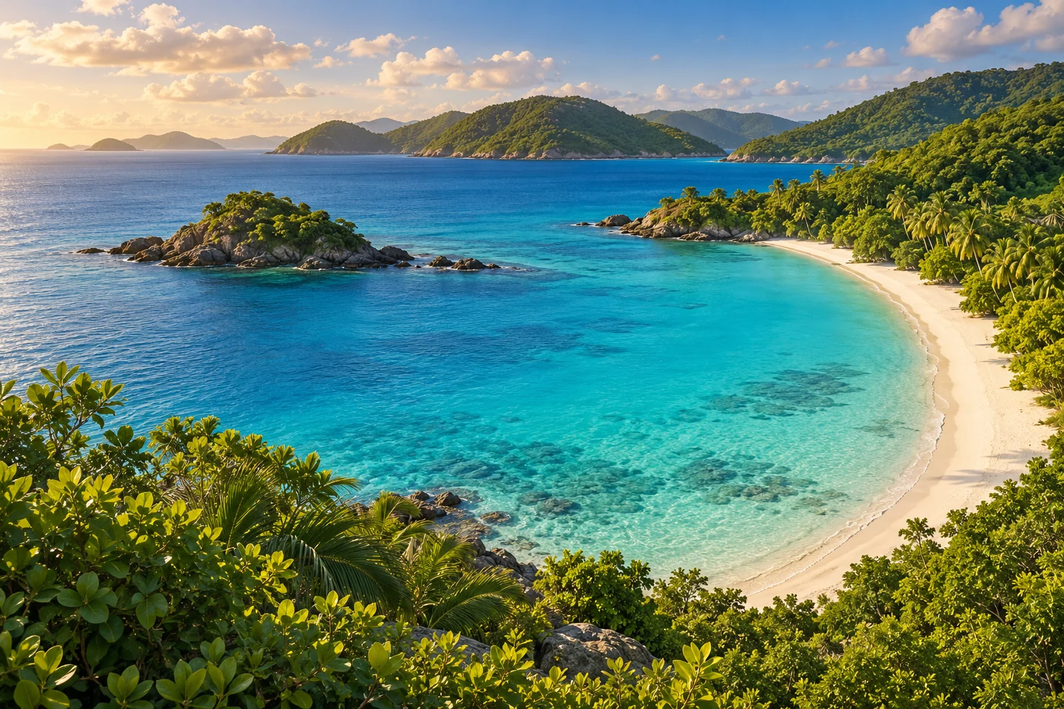
At Trunk Bay on St. John, underwater signs introduce swimmers to coral-reef life and conservation. The trail turns a familiar park experience into something unusual: visitors read the interpretation through a mask while floating above the habitat. Its purpose is to make a living reef intelligible. The beach's famous view is therefore only the entrance to a landscape with its own signs, residents and ecological relationships.

9. A walk through Reef Bay crosses different historical worlds
The Reef Bay route leads toward petroglyphs and then the remains of a sugar mill near the coast. That sequence places Indigenous cultural evidence and later plantation industry within one valley. It is a reminder that the islands' history begins long before European estates. The landscape holds overlapping histories whose traces survive in different materials, from carved rock to masonry and machinery.
10. A national monument protects thousands of acres below water
Virgin Islands Coral Reef National Monument encompasses 12,708 submerged acres around St. John. Its protected habitats include reefs, seagrass beds, mangroves and deeper marine environments. A monument need not have a tower, statue or even much dry land. Here the important boundaries extend across water that may look uniform from shore but contains habitats linked to different stages of marine animals' lives.
11. Corals can grow among mangrove roots
Hurricane Hole supports an unusual community of corals on and near red mangrove prop roots. Research summarized by the National Park Service documented more than thirty stony-coral species there. Shade and variable environmental conditions have interested scientists studying resilience to heat stress. The setting complicates the familiar picture of a coral reef as something found only in bright, open water away from coastal trees.
12. Hurricanes can transform even a sheltered marine habitat
Irma and Maria badly damaged Hurricane Hole in 2017, uprooting mangroves and stripping organisms from their roots. The damage demonstrated how closely the above-water forest and underwater community depend on one another. Scientists documented both losses and questions about recovery. A bay's reputation as a storm refuge does not make its ecosystems immune to powerful waves and wind.
13. Buck Island's protection has expanded over time
Buck Island Reef became a national monument in 1961, following an earlier territorial park designation. In 2001, its protected area was enlarged substantially. The history reflects a widening understanding of conservation: protecting a small island also requires considering the surrounding marine habitats. Its beaches, reefs and waters belong to one connected setting rather than separate attractions that happen to sit beside each other.
14. Salt River Bay records an encounter from Columbus's second voyage
Salt River Bay on St. Croix preserves evidence of Indigenous settlement and the 1493 encounter with Columbus's expedition. Its archaeological record also includes later European colonization and the lives of enslaved Africans and their descendants. The site's importance comes from that long sequence of occupation. A single voyage is one episode within a much older and much longer human history.
15. Bay leaves once supported an important local industry
St. John's historical economy included collecting bay leaves and processing them into oil used in products such as soaps, shampoos and colognes. After emancipation, islanders built livelihoods beyond plantation labor, including bay oil and charcoal production. That history broadens the image of an island economy beyond sugar and modern tourism. A familiar fragrance can carry the story of communities making new economic choices.
How did these facts land?
Know someone who'd love these facts? Share them 👇